Safer Streetscape
Better Design for Safer Streets
Simple, inexpensive changes can make streets safer for everyone. Here are some visualizations of how Provincetown could use temporary traffic calming measures and best practice designs on our local streets
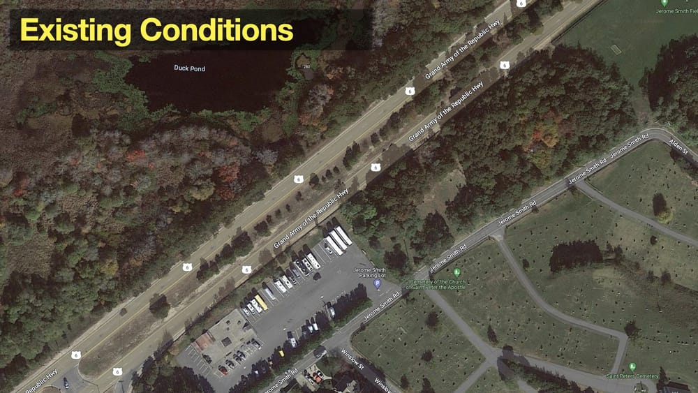
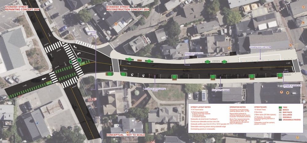
Visualizing a better Standish Street
Standish Street is a gateway to Provincetown’s waterfront. It’s also a designated bike route to the Cape Cod National Seashore. And it carries thousands of visitors on foot, buses on their way to the bus stop, sightseeing vehicles, and lots of cars heading to the MacMillan Pier parking
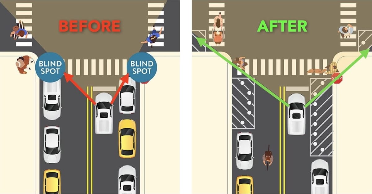
What is Daylighting?
Daylighting is creating “clear zones” at intersections so that everyone can see each other. Doing this can reduce injuries by up to 30% (Bloomberg, FHWA) In Provincetown, there are already laws and local regulations in place to support this approach… they’re just not implemented. Key Daylighting Tactics • Daylighting Best
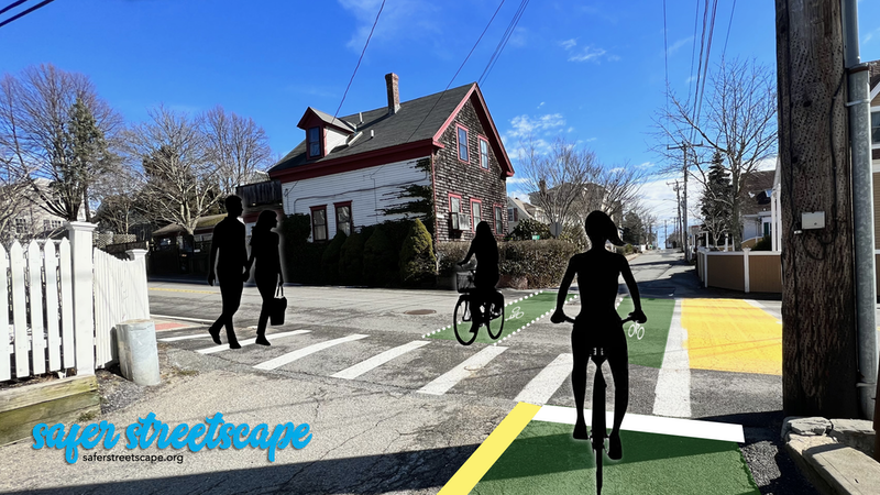
Reimagining Standish Street north of Bradford Street
Standish Street is part of a low-traffic bike route from MacMillan Pier to the bike trails at Beech Forest in the Cape Cod National Seashore. Recent retail development has increased the number of motor vehicles using this intersection. When CVS came to town, it was required to build sidewalks and

Reimagining Winthrop Street at Bradford Street
There’s a lot of bike traffic across this intersection in both directions. It’s the primary low-traffic route to and from the Stop & Shop supermarket on Shank Painter Road, and is commonly used as a two-way route despite part of the street being marked as one-way for cars. In
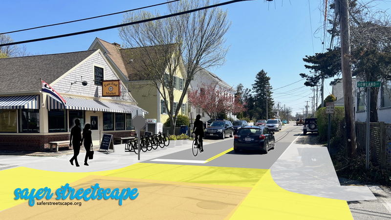
Reimagining Howland Street at Bradford Street
This intersection has the first stop sign coming into town from the east, and there are always lots of people walking and biking year-round to travel to and from the East End Market. In this visualization, painted sidewalks and curb extensions define the space to shorten the crosswalks, a bike
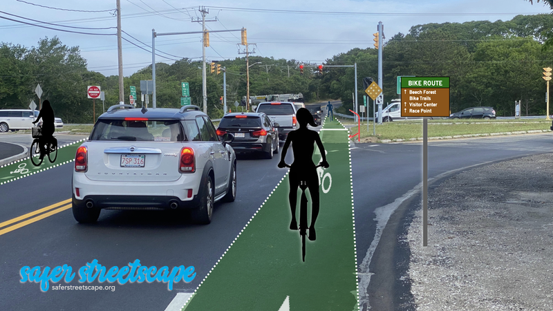
Reimagining Conwell Street at Route 6
Here’s another of our 1950s-era intersections that is in need of updates, and this time the focus is on bicycling. (Google Map) When Conwell Street was rebuilt a couple of years ago to add bike lanes and a sidewalk, they gave up when they got to this intersection. The
Major Project Design Reviews
What’s missing from the Shank Painter Rd plan?
The Shank Painter Road Project hit its “75%” engineering plan target in April 2024 when the latest version of the plan was submitted to MassDOT for review. This revision was delayed from November 2023 due to some really huge drainage and sewer engineering that was included to address persistent flooding
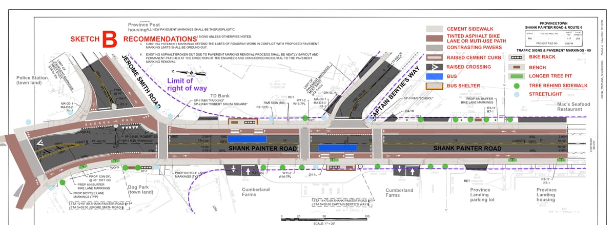
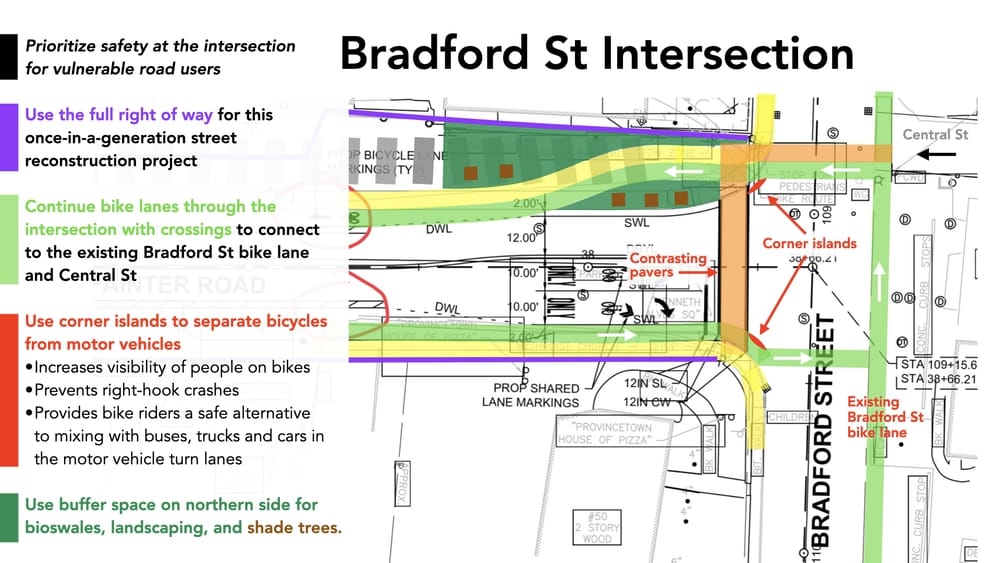
Reimagining Shank Painter Rd with Protected Intersections
Protected intersections don’t need be huge projects, and they don’t need to be at signals. Elements like turning islands can be used at busy bike intersections where there are just stop signs. The upcoming Shank Painter Road project in Provincetown has two intersections that could easily be adapted
Visualizing a Protected Intersection in Wellfleet
A MassDOT project in Wellfleet that is about to start construction in fall 2023 is a good example of a lost opportunity. The intersection of Route 6 and Main St is getting rebuilt with sidewalks and bike lanes, but it isn’t designed as a protected intersection. I’ve spent

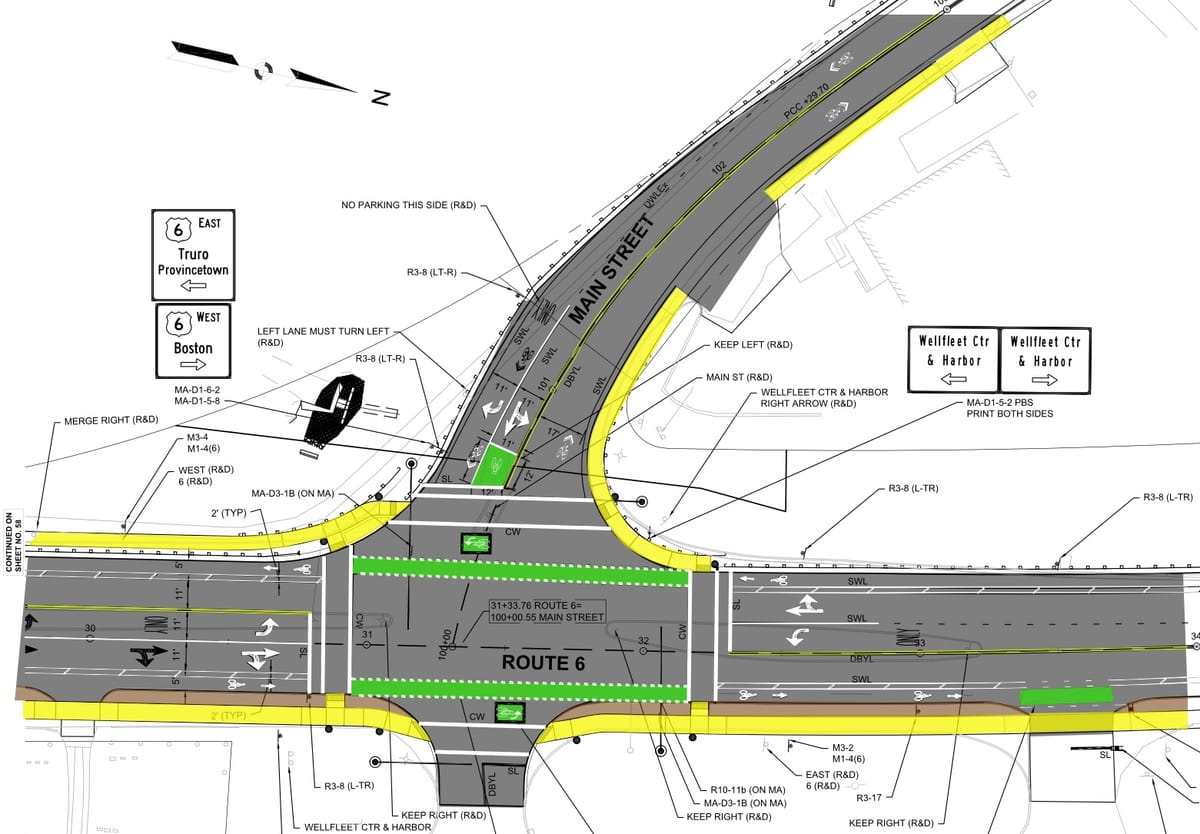
Wellfleet’s Main St at Route 6 intersection
MassDOT’s Main St at Route 6 intersection design is so disappointing. I last wrote about it here in 2020. I stumbled on the final engineering plans for this project recently and realized it was time to take a deeper look at what MassDOT will actually be building. The project
Reimagining Route 6
Route 6 as it is today. Shank Painter Road intersects at the lower left, and the signalized intersection with Conwell St is about 2000 ft to the upper right. (Google map) Request for Proposals The town issued a request for proposals last week for a consultant to come up with